Introduction
- CountryJapan
- GovernmentMiyagi Prefecture
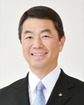
- GovernorMURAI Yoshihiro
Symbol

Symbol
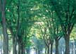
Tree
Zelkova
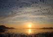
Bird
Goose
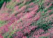
Flower
Bush Clover
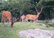
Animal
Deer
History
- Growth of Miyagi Prefecture
Miyagi Prefecture, along with Fukushima and Iwate Prefectures, was known collectively as Mutsu Province about 1300 years ago. Its central government was located in Tagajo Castle. About 400 years ago, Date Masamune built a castle in Sendai and laid the foundations for the Sendai Domain. In the first year of the Meiji era (1867), Sendai surrendered in the Boshin War* and became Sendai Prefecture in the fourth year of the Meiji era before becoming Miyagi Prefecture in the following year. Since then, the prefecture has undergone several abolitions and revisions before attaining its current form in the ninth year of the Meiji era. - The Origin of Miyagi
There is a theory that the prefecture derived its name from the previous county name, Miyagi County. Another theory states that the name Miyagi comes from “miya” which means shrine, such as Shibahiko Shrine and Shiogama Shrine, and “ki” which means castle, such as in Tagajo. In addition, there is a theory that the name originated from “miyake,” which means the area falling under the direct control of the anicent Yamato administration, but the pronunciation later became distorted and became “Miyagi.”
*Boshin War: a civil war in Japan between forces of the ruling Tokugawa Shogunate and those seeking to return political power to the Imperial Court
*Abolition of Domains and Establishment of Prefectures: a reorganization of administrative districts in which feudal domains were abolished and prefectures were established, changing the government system from a decentralized one to a centralized one.
Topographic Features
- Miyagi Prefecture is located approximately 300km northeast of Tokyo, the capital of Japan. It is bordered by the Pacific Ocean to the east, boasting abundant fishing grounds and the beautiful Matsushima, one of Japan's three most scenic spots. To the west lie Mount Zao, Mount Funagata, and Mount Kurikoma, forming a continuous range that showcase the changing landscape with the seasons. In the central part, the expansive Sendai Plain, known for its fertile farmland, stretches out over many kilometers.
Basic Information
| Category | Contents |
|---|---|
| Geography/Climate |
|
| Population |
|
| Major Events |
|
| Tourist amd Cultural Attractions | Matsushima, one of Japan's three most scenic spots, Shiroishi Riverbank Cherry Blossom Gove, Minamisanriku, a scenic shopping street in Miyagi, Meijimura, a histroic museum in Miayagi, Ishinomori Manga Museum, dedicated to the manga artist Ishinomori from Miyagi, Naruko Onsen, a hot spring in Miyagi, Shizugawa Bay in Miyagi, Akihoh Waterfall in Miyagi, Izunuma and Uchinuma Lakes, Mount Kurikoma and Abukuma Gorge, Mount Zao in Miyagi |
| Sisterhood & Firendship Provinces/Cities |
|
Economic Status
| Category | Contents |
|---|---|
| Economy |
|
| Industry | Industrial structure(as of 2015): Primary Industry 1.7%, Secondary Industry 35.8%, Tertiary Industry 62.5% |
| Commodities |
|
Others
| Category | Contents |
|---|---|
| Contact |
|
| Website | https://www.pref.miyagi.jp |