Introduction

- NationJapan
- Government NameIshikawa Prefecture
- GovernorHase Hiroshi
Symbol

Emblem
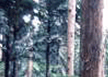
Tree
AtEA
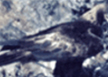
Bird
Japanese Golden Eagle
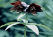
Flower
Black Lily
History
- The area of Ishikawa belonged to Echizen (today Fukui Prefecture) from 650, but Kaga (the northern part of Ishikawa) and Noto (the southern part of Ishikawa) were separated in 718 and 823, respectively. In the middle of the Heian period, the political situation became unstable. In Kaga, Mr. Togashi became powerful and in Noto, Mr. Hatakeyama reigned.
- In Bunmei 3(1471), Rennyo, who was a monk of Hongan temple, spread the precept of a Buddhist invocation and disciples of Kaga Hongan temple became powerful and ruined Masachika Togashi a“t the Ikko ikki riot”. Then, Kaga became known as“County which farmers own”and the county was governed by religious politics. This continued for more than 90 years.
- In Noto, Mr. Hatakeyama was defeated by Kenshin Uesugi at Nanao, then Nobunaga Oda's troops governed and Toshiie Maeda ruled. In Tensei 11(1583), Toshiie Maeda was given the area around Oyama castle, and in Tensei 12(1584), he became ruler of the 3 counties of Ecchu. His son, Toshiie (Junior) was given the Southern Kaga area because of his valiant fighting spirit during the Sekigahara war. In Meiji 4(1871), 3 prefectures, Kanazawa, Daisyoji and Toyama, were settled by Haihan Chiken law. In Meiji 16 (1883), after many land divisions and combinations, the present day prefectural area was established.
Topographic Features
- Ishikawa prefecture is located in the middle of the Hokuriku region. To the East are Toyama and Gifu prefectures, to the South is Fukui prefecture, and to the North is the Noto peninsula jutting out into the Sea of Japan (East Sea). The shape of the prefecture is long and narrow from the Southwest to the Northeast, and is 100.9km from East to West and 198.4km from North to South. To the South is the Hakusan National Natural Park from where the Tedori river springs and feeds the rich Kaga plain, and to the North is the Noto peninsula that extends into the Japan sea...
Basic Information
| Contents | |
|---|---|
| Geography/Climate |
|
| Population |
|
| Major events |
|
| Tourist Attractions |
|
| Sisterhood & Friendship Provinces / Cities |
|
Economic Status
| Contents | |
|---|---|
| Economy |
|
| Industry |
|
| Products |
|
Others
- Contact:Bureau of Tourism Exchange, Department of International Exchange .
- Address: 石川県 金沢市 鞍月 1-1
- Tel.:+81-76-225-1316
- Fax.:+81-76-225-1315
- Official Website : http://www.pref.ishikawa.jp